Share Diamond Lake Regional Trail Master Plan on FacebookShare Diamond Lake Regional Trail Master Plan on TwitterShare Diamond Lake Regional Trail Master Plan on LinkedinEmail Diamond Lake Regional Trail Master Plan link
Project Background and Status
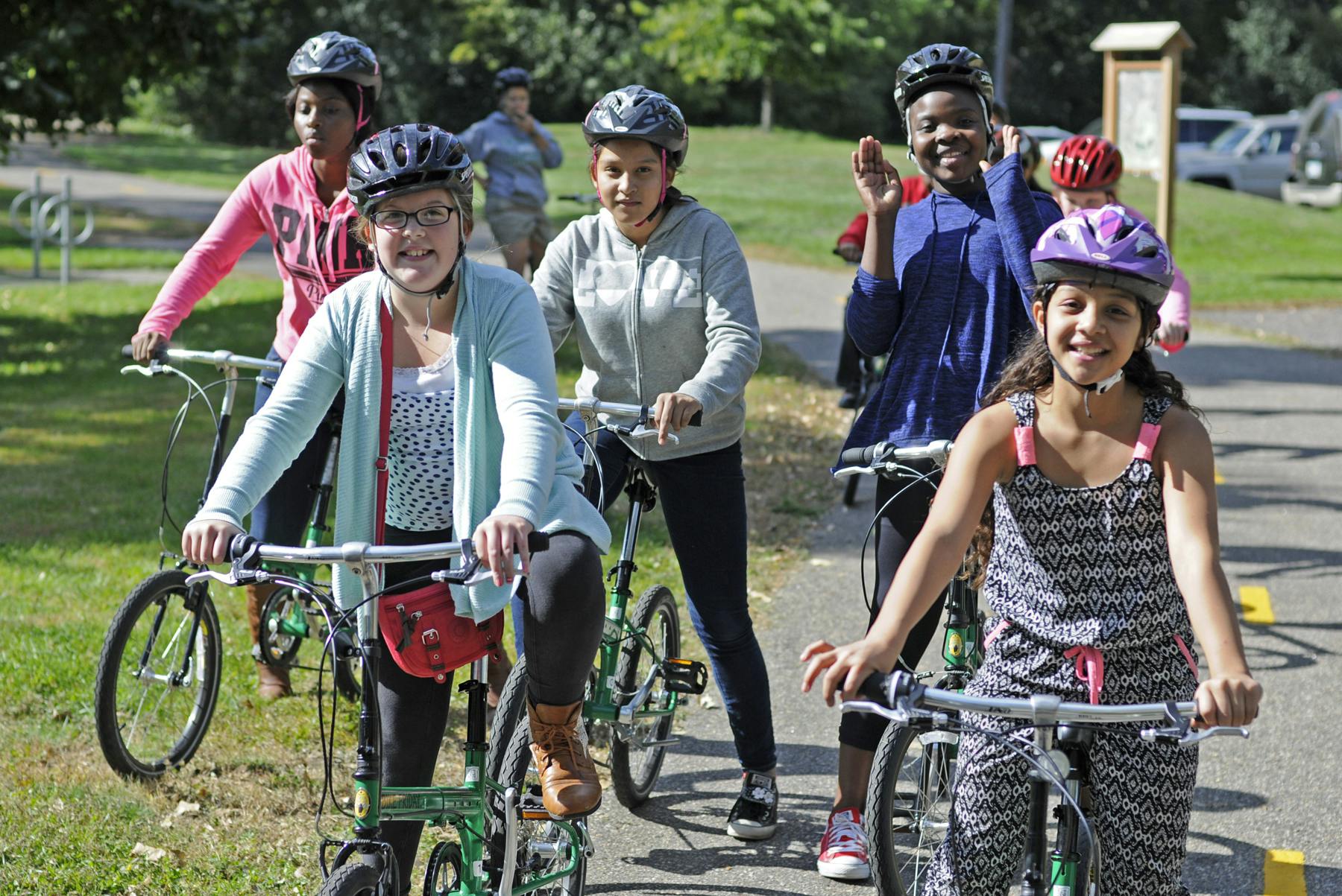
Three Rivers Park District is leading a master planning process for the Diamond Lake Regional Trail - a new north-south 10-foot-wide paved, multi-use regional trail through western Hennepin County which would allow biking, hiking, dog walking, running, and in-line skating.
In 2020, Three Rivers obtained extensive feedback from the community and coordinated with city partners along the proposed route to determine and approve the preferred route for the regional trail. The Diamond Lake Regional Trail is now envisioned to connect to the West Mississippi River Regional Trail in Dayton at its northern terminus and travel through Rogers and Corcoran to the Lake Independence Regional Trail and Baker Park Reserve in Medina at its southern terminus. After additional public engagement in 2021 and at the request of the cities of Medina and Long Lake, the preferred route for the regional trail will avoid southeast Medina and the City of Long Lake.
This planning effort also envisions a north-south trail connection in Wayzata and Orono linking the Dakota Rail Regional Trail and Luce Line State Trail. This trail connection will be called the Dakota Rail – Luce Line Connector Regional Trail. This trail connection, along with the existing trail connection of the Luce Line State Trail and the Lake Independence Regional Trail, will provide the contiguous trail route that was originally envisioned for the Diamond Lake Regional Trail corridor.
For quick reference, a PDF map of the preferred route for the Diamond Lake Regional Trail approved by each community is available here.
A detailed, interactive map for the preferred route is available here.
30-Day Public Comment Period
Three Rivers Park District has completed the draft master plan for the Diamond Lake Regional Trail and Dakota Rail – Luce Line Connector Regional Trails.The 30-day public comment period took place from May 4, 2022, through June 3, 2022. View the updated draft master plan.View the master plan appendices, including comments received during the public comment period.
Following Metropolitan Council approval and final adoption of the completed master plan by the Three Rivers Park District Board of Commissioners, Three Rivers will work to secure funding and work with willing sellers and partners to secure required property rights and commence trail construction. Trail construction will occur in multiple phases as funding and development opportunities allow and will likely take two to three decades to fully achieve.
Project Background and Status
Three Rivers Park District is leading a master planning process for the Diamond Lake Regional Trail - a new north-south 10-foot-wide paved, multi-use regional trail through western Hennepin County which would allow biking, hiking, dog walking, running, and in-line skating.
In 2020, Three Rivers obtained extensive feedback from the community and coordinated with city partners along the proposed route to determine and approve the preferred route for the regional trail. The Diamond Lake Regional Trail is now envisioned to connect to the West Mississippi River Regional Trail in Dayton at its northern terminus and travel through Rogers and Corcoran to the Lake Independence Regional Trail and Baker Park Reserve in Medina at its southern terminus. After additional public engagement in 2021 and at the request of the cities of Medina and Long Lake, the preferred route for the regional trail will avoid southeast Medina and the City of Long Lake.
This planning effort also envisions a north-south trail connection in Wayzata and Orono linking the Dakota Rail Regional Trail and Luce Line State Trail. This trail connection will be called the Dakota Rail – Luce Line Connector Regional Trail. This trail connection, along with the existing trail connection of the Luce Line State Trail and the Lake Independence Regional Trail, will provide the contiguous trail route that was originally envisioned for the Diamond Lake Regional Trail corridor.
For quick reference, a PDF map of the preferred route for the Diamond Lake Regional Trail approved by each community is available here.
A detailed, interactive map for the preferred route is available here.
30-Day Public Comment Period
Three Rivers Park District has completed the draft master plan for the Diamond Lake Regional Trail and Dakota Rail – Luce Line Connector Regional Trails.The 30-day public comment period took place from May 4, 2022, through June 3, 2022. View the updated draft master plan.View the master plan appendices, including comments received during the public comment period.
Following Metropolitan Council approval and final adoption of the completed master plan by the Three Rivers Park District Board of Commissioners, Three Rivers will work to secure funding and work with willing sellers and partners to secure required property rights and commence trail construction. Trail construction will occur in multiple phases as funding and development opportunities allow and will likely take two to three decades to fully achieve.
If you have general comments about the Diamond Lake Regional Trail planning process, please share them here.
You need to be signed in to comment in this Guest Book. Click here to Sign In or Register to get involved
There is a lot of car traffic pulling into and out of Birch's from employees, customers and rowing club members. It seems dangerous to encourage cyclists to cross their driveways. I would hate to hear about accidents and lawsuits. It would seem to make more sense to encourage cyclists to stay away from car traffic and onto the existing trail along the Highway 12 sound wall.
Long Lake Resident
Over 4 years ago
We are supportive of development of the Diamond Lake Regional Trail. It is a great plan that will hopefully kickstart plans of for many more trails in Corcoran. We are avid bike riders that must ride dangerous roads just to get to the many great trails in Maple Grove. Thank you for your efforts!
Corcoran Citizens
Over 4 years ago
I would like to submit a request for an additional walking trail between Brown Road and Willow Road in St. Louis Park. There are a lot of homes with young children and/or pets who would greatly benefit from the safety of a walking trail along Highway 6.
quinny0206
Almost 5 years ago
Dear Three Rivers Park District Medina City Council & Park Commission
Following our my comments regarding the DLRT.
For a number of reasons I am opposed to the Diamond Lake Regional Trail, I have stated a few below.
Years ago my wife and I lived in Minnetonka, our yard abutted up to a trail, we did not think much about it when we purchased the house. It was a mistake on our part thinking that there would not be much interaction between us and the people using the trail. We were wrong, we found out very soon that people did not hesitate to come into our yard when we were doing yard work or sitting on our deck just to make conversation. When we decided to move we agreed that we would move to a town / city that gave us the peace and quiet we were looking for and plenty of open space and away from trails and parks. We found that gratification when we purchased our home on Hamel road in 1991. We have nothing against parks or trails, they serve a purpose for the community. If someone wants to live next to a trail or park that’s their prerogative, for us it’s a hindrance. Please don’t bring it to our doorstep. If we want to go to a park or preserve we’ll drive our car.
Why would I want to walk to a park that is 4 to 5 miles from my house one way, further for many other people. We have plenty of trails and parks already in this area, we do not need a trail to get to them. It’s mentioned in the video that bikers will use the trail, that is highly unlikely. They do not like sidewalks or trails, they prefer to ride on the roads, three abreast at times. Also I have not seen an abundant of people roller blading these past years.
Having the DLRT run along Hamel road is a real safety issue. As you are all aware it’s a county road, on any given day there are countless trucks, semi-trucks, UPS and FedEx trucks not to mention all the Hennepin County dump trucks, graders and other implements that travel the road on a daily basis. Not all of the vehicles and trucks obey the speed limit. There are also many hills, curves and blind spots on Hamel Road. Not a safe road to have a trail.
What environmental impact will this trail have on the environment? How many miles of earth will be dug up and reworked? What about the wetlands along the way? How much more drainage will there be with all the hard surface this trail would add.
It’s been mentioned that this trail could take years if not decades to accomplish, that statement concerns me. I was told years ago at a city council meeting that the radio tower by Hennepin County was going to be approximately 200 feet high, when it was passed and erected it topped out around 400 feet. With all of the planning and meetings this past year it seems that this segment of the trail is on the front burner and would be completed in the near future and not ten or twenty years from now. What is the timetable for this segment of the trail no matter what corridor is decided?
If I understand correctly some government grant(s) / funding may be used to fund this project, do those grants come with any government regulations or guidelines? If they do I think the citizens of all the cities should be made aware of them. I also heard on the video that tax dollars will also be used to fund and maintain the trail. What is the cost of the project and how much per year will it cost to maintain it? Do you have any projections on how many people will use the trail. How often will it be used in the winter? One should ask themselves if this is the best way to use our tax dollars.
I’m sure by my comments above you realize that I do not support this trail going along Hamel Road or any other road. I know a large majority of the residents along my area of Hamel Road do not want to bear the burden or publicly support the Diamond Lake Regional Trail.
Thank you for your time. D&B Hamel
D&B Hamel
Almost 5 years ago
I am completely in support of this trail. My family rides and runs on many of the Three Rivers Trails every week. I ride my bike on Hamel Road and CR-24 weekly and feel unsafe often and have had some close calls along these road but currently there are few trails connecting the western suburbs to Wayzata and/or Baker park. The grade separated crossing of HW55 is critical - there are few safe ways to cross 55 currently. I would suggest that the trail connects to Elm Creek to create a larger loop and more regional connectivity. I would also prefer either the eastern or western “meandering” northern options vs. the straight N-S path along 116. Thank you.
Derek
Almost 5 years ago
On 18 August, 2020, the City of Medina approved the Tamarack Drive Corridor Visioning Study. When the Wayzata School is built, there will be stoplight with several turn lanes plus a round-about just north of Hwy 55 on Tamarack Drive. This will be a very busy area for both commercial and residential traffic because the frontage areas along Hwy 55 are zoned for commercial use. The westerly route, would be the more favorable route in terms of safety and for ADA access to the bridge. For detailed information regarding the Hwy. 55 and Tamarack Drive intersection and the round-about to the North on Tamarack Drive, see the August 18, 2020 Tamarack Drive Corridor Visioning Study Final Concept Plan, City of Medina Council Meeting, starting at about 32 minutes: https://vimeo.com/464079318.
CarolS
Almost 5 years ago
As a member of the Jubert Family that owns the property located at 1182 Highway 55 in Medina (on the north side of Highway 55 and the east side of Tamarack Drive), I want to make several comments about the easterly trail that has been proposed for the Diamond Lake Regional Trail.
Back in 2012, our family donated all the required City of Medina park dedication for our entire piece of land at the time (approximately 62.5 acres). The 2012 City of Medina park dedication included what is now the Fields of Medina (East), the Lennar Townhome development currently under construction, and the remaining acres the Jubert Family owns along Highway 55 that are zoned as 'commercial.' Our entire park dedication became what is now 'The Park at the Fields of Medina.' It would be unfair to us to take any of our additional land for the Diamond Lake Regional Trail when there are other options available.
Another point to consider is that there is a round-about planned on Tamarack Drive (north of Highway 55 and south of Meander Road). This round-about is planned to cut into our land--though it does not show up on the recent Diamond Lake Trail maps.
In addition, the Wayzata School District has purchased the land south of Highway 55 and along Tamarack Drive for future use. The construction of the new Wayzata School south of Highway 55 will create the need to upgrade the intersection at Highway 55 and Tamarack Drive with a stoplight.
The distance from Highway 55 north to Meander Road is less than one-half mile. If you look at the 'big picture,' you would see that this is a small area where a lot would be going on--cars, walkers, bikers, maybe busses, and then possibly additional trail bikers! Once this stoplight is installed, it will become a busy intersection with residential and commercial traffic. To have a bike path near this intersection would create more congestion and possibly be a hazard to those traveling in this area.
The safer route would be the westerly route, because there are more open spaces, the planning for a trail is more open since the land is not already developed or in the design phases. For these reasons, we propose that the more-westerly route through quieter areas, less congestion, and more room for a bridge with ADA compliance is a better option for the Diamond Lake Regional Trail.
Jubert Family
Almost 5 years ago
I live in Medina on County Road 19 and bike east on hamel road from the Baker Park trail about once a month in biking weather. I would do it more often but Hamel Road has no shoulder and it is just too nerve racking to do the steep hills with any cars passing. I am very much in favor of the trail connection to Diamond lake trail. It would make a trip to Target and Hamel businesses much safer. It is not clear from the Map if the Hamel Road section would actually be separate from the road. Medina puts the road shoulder on Co Rd 24 as part of their existing trails. That road shoulder is wide enough, but it is not safe for children to ride along the Co Rd 24 traffic. This should be separate, and paved, not crushed limestone or gravel.
Walter Steinkraus
Walter Steinkraus
Almost 5 years ago
My wife & I live on the trail on land that has been in the family for decades & would not only affect our property immensely but her brother's farm as well. We moved out here to be by her father & enjoy the privacy it has to offer & would not appreciate the trail going through our front yard.
I have heard people compare this proposed trail to the one on CR19. There is no comparison. The CR 19 trail is mainly flat, straight with open fields. This road has curves & hills; a cemetery & a pond next to the road; not to mention the trees that would have to be cut & the ditches that would have to be filled. What would be the environmental impact from this?
I urge the CITY COUNCIL & PARK COMMISSION members to take a slow drive down Hamel Road & look to the sides of the road 12 -20 feet & think what would have to be destroyed in order for this to be built. It's just not feasible.
It's hard for me to fathom the amount of money this is going to take to build this trail by the Park District. But then, I look on a larger scale & look at the light rail spending by Met Council which is totally out of control. It seems like the money could be better spent.
The majority of comments for the trail are from people who do not have this proposed trail going through their property. We are against the Hamel Road route & feel there are more viable options that need to be explored.
Thank you.
Buddy
Almost 5 years ago
I have been a resident of Corcoran for 10 years, I have children and we all need this trail! Our neighborhoods need to be safe for walking and biking, and without sidewalks right now they are not. Please also consider extending the path along 47 between 116 and 101. This is a road between lots of neighborhoods that currently has lots of bikers and walkers and creates dangerous situations for pedestrians, bikers, and cars without a path. Overall, we are VERY supportive of this path and THANK YOU!!! We love that it connects to Baker. This will be great for the environment as we will finally be able to walk and bike from our home instead of needing to drive to places to walk and bike.
Lindsay
Almost 5 years ago
First and foremost, I would absolutely be in favor of a new trail. I run and bike ride every week but I am also an avid horseback rider. I grew up on Tamarack Drive with a horse boarded at Fortuna Farm and have ridden the trails in the Wolsfeld Woods most of my life. My husband and I were fortunate enough to buy a horse property on County Road 24 and we enjoy riding these trails almost daily. Medina is such a big horse community, it has always surprised me there are so few places like this to ride. Not every horse person has access to a trailer to get to some of the larger trail systems so they rely on these trails. If you look at a map of the Wolsfeld Woods, you will notice that there actually is no public access point to the horse trails. We rely on the generosity of the surrounding landowners to access it. I get so much joy as I see many horseback riders (and even the Long Lake Hounds hunt club) ride along our property line down Iroquois Drive to get to the trail in our backyard. The proposed route of this bike path in this location would be placed directly on top of the current horse trail in some areas, would directly impact access for horseback riders, and would negatively affect the conditions in the Wolsfeld Woods SNA. It is unfortunate, but there are always a few people that won’t follow the rules and will bike there anyway. If you give bikes access to this area even further, it will create some serious safety concerns between horses and bikes. Even on the Luce Line enough mountain bikers come speeding down the horse trail that it creates a very dangerous situation. Based on other comments here and on the interactive map, it seems it would solve a lot of concerns if you would skip this small portion of the trail and just use the Tamarack Drive route. Please take this into consideration when creating your master plan for this trail system.
KME
About 5 years ago
I am very much in favor of the new Diamond Lake Regional Trail. I see a lot of development occurring in this area and the trail is an opportunity to provide a corridor for recreation and non motorized travel. It represents a low density use of an area that is certainly destined to be developed in the near future. When I look at the new development near Hy-Vee on 101 and Bass Lake road and other nearby areas I am glad that Three Rivers Parks is planning this route. Other regional trails have been popular and shown to increase property values. Now is the time for this route. It will preserve some of the nature in the area. Once it's developed for apartments and houses, it's gone for good.
Richard Anderson
About 5 years ago
Placing a trail through or along a Scientific and Natural Area [where dogs are prohibited, and where undisturbed areas are set aside for scientific research] seems contradictory to the purpose of a SNA. No transportation corridor presently goes along or through Wolsfeld Woods, west of Tamarack. Would introducing a public use trail place any negative impacts on the species and habitats there, especially since nothing exists there now? Do the covenants of the SNA allow for this usage and intrusion? Horseback riding in Wolsfeld Woods is a special privilege not enjoyed in many other SNAs, if any. Is this usage consistent with the spirit of the original establishing of this SNA that does allow for horses? How would horse/bike encounters be minimized and made safe? Given the present situation, where bikes are not allowed, and horses are, would horse be given preference in the planning and these encounters? The SNA has some areas of very steep slopes and erosion; horse riders know to avoid these areas at certain times of the year. How would this trail deal with keeping mountain bikers who presently have no readily gained access to these areas from using these steep slopes, and causing severe erosion? Would the use and condemnation of land from the 2 SNAs result in the need for replacement of the land through the Federal Land and Water Conservation Act? How would dogs and people be prevented from over-use of the area? Has over-use been defined for the SNAs? What would constitute too much usage and pressure, and then what would happen to the trail usage? Because the western Tamarack portion of the trail relies on placing a new transportation corridor adjacent to an SNA, the other Tamarack option, or the Hunter Drive option should be used. Would there be less visual impact onto private landowner's homes if the trail were to be placed on Hunter vs Tamarack? Would there be less intrusion into resident's actively used land? Would more trees remain to buffer homes from the trail along Hunter or Tamarack?
CWP
About 5 years ago
After listening in on a couple of meetings and reviewing the comments, I am writing to voice my support for the proposed shared-use trail. I bike regularly around Medina and appreciate the well-maintained trails we have in the area. I have found sharing the trails with other bikers, hikers and skaters to be a largely courteous and respectful exchange. I treasure those parts of the trail where the roar of the traffic is diminished, and the air Is free of exhaust. I also appreciate the concerns raised by the horse-owners in Medina, several of whom are my neighbors. I support their wishes for allowing enough space so as not to distress their animals or unduly invade their privacy. In the more than 30 years I have been a resident of Medina, I have witnessed how their options for riding trails have become increasingly limited. A few decades ago, an annual foxhunt would sometimes, with our permission, cross a portion of our property. But even the modest level of development since then in the area makes that no longer possible. Some assurance by Three Rivers to preserve or even expand a few riding trail options for horses may help us find the right balance and dispel a legitimate concern that horse-owners are getting crowded out. Since this project won’t be completed for many years, I may never get the chance to ride on the trail. But us my hope that when some new family moves into my place, they will be able to enjoy the beauty of this area by horse, skate, bike or foot as they choose. And they can practically do it out their back door!
Noel Martinson
About 5 years ago
I moved to Medina about a year and a half ago to enjoy the beautiful property and privacy. I do NOT support the bike trail. I believe those who bike will still be on the street even if there is a path. I would expect a decrease in my very high property taxes if this path runs down Hunter Drive.
Hunter Drive Resident
About 5 years ago
Listen to the last meeting I, know there are neighbors that may be opposed to the trail but we are more than thrilled to see a north-south trail we have lived in Medina over 30 years and we are property owners that are along the trail where we have lived for over 20 years we have no problem with this trail running through this edge of our property. Also Medina road is a terrible road for bikers and walkers cars go away over the speed limit and there is no shoulder to ride on or walk on. For years we have dreamed of a. Bike trail or a wider shoulder on Medina Road. We definitely support this long-term project
AKF
About 5 years ago
Any trail route should follow existing public easements and roads, whenever possible. These routes are currently being used, and will continue to be used by bikers and walkers, regardless of other options. It only makes sense to support those currently-used pathways and to make those pathways safer, rather than engage in the incredibly expensive and extensive construction that would be required through private land acquisition of backyards and private stretches of natural, unpaved wooded and wetland. There is no need to pave paradise.
An expenditure of this size and the potential level of impact on individual landowners require better efforts in the following areas:
• Care taken in informing those directly impacted; • Efforts to minimize private land impact and the potential for pressured sales and depressed land values from the specter of a bike path passing through private property; • Clearly-communicated, extensive, and careful justification to the taxpayers , including an overview of what other potential infrastructure projects are not being funded at the expense of supporting the DLT project of this magnitude; and • Binding, clear, and public commitment to not force sales by private landowners, whether through eminent domain or the potential threat of such activity.
Concerned Medina Resident
About 5 years ago
Providing safe pedestrian and bicycle facilities reduces carbon emissions, facilitates physical fitness, enhances communities, and allows people to connect with nature. Projects such as this are priceless in their potential to improve the environment, reduce medical costs through improved physical and mental health, and support communities by connecting people to key destinations (parks, shopping, etc.).
We live near 19 and Baker Park and have experienced the benefits of the nearby trail, and support projects that will benefit our neighboring communities.
Thank you for your vision and hard work.
Medina Resident
About 5 years ago
The trail should go though a future park on the south side of Diamond lake. This trail project is years away and that will give the city the time needed to work with the land owners on acquiring the property. This is consistent with Dayton's master plan
Doug Baines
Over 5 years ago
I have lived in Corcoran for almost 34 years and have loved it. I understand that communities grow and change. I appreciate and have enjoyed the Three Rivers Parks. I am having a difficult time understanding the need and plan for this bike trail. I understand the motivation for a north to south route through these communities, but the expense and impact that an asphalt trail would have on nature and the privacy of landowners is not justifiable. I don't understand why TRP would not connect this trail from the northeast with the regional trail along Co.Rd 19. Not only would this be way less expensive, safer and quieter, more "park-like", and it would end at the Luce Line State trail just west of downtown Wayzata. Please consider this idea; you would achieve your trail route goals, have more funds for other projects, and make so many people( bikers and landowners) happy!


There is a lot of car traffic pulling into and out of Birch's from employees, customers and rowing club members. It seems dangerous to encourage cyclists to cross their driveways. I would hate to hear about accidents and lawsuits. It would seem to make more sense to encourage cyclists to stay away from car traffic and onto the existing trail along the Highway 12 sound wall.
We are supportive of development of the Diamond Lake Regional Trail. It is a great plan that will hopefully kickstart plans of for many more trails in Corcoran. We are avid bike riders that must ride dangerous roads just to get to the many great trails in Maple Grove. Thank you for your efforts!
I would like to submit a request for an additional walking trail between Brown Road and Willow Road in St. Louis Park. There are a lot of homes with young children and/or pets who would greatly benefit from the safety of a walking trail along Highway 6.
Dear Three Rivers Park District
Medina City Council & Park Commission
Following our my comments regarding the DLRT.
For a number of reasons I am opposed to the Diamond Lake Regional Trail, I have stated a few below.
Years ago my wife and I lived in Minnetonka, our yard abutted up to a trail, we did not think much about it when we purchased the house. It was a mistake on our part thinking that there would not be much interaction between us and the people using the trail. We were wrong, we found out very soon that people did not hesitate to come into our yard when we were doing yard work or sitting on our deck just to make conversation. When we decided to move we agreed that we would move to a town / city that gave us the peace and quiet we were looking for and plenty of open space and away from trails and parks. We found that gratification when we purchased our home on Hamel road in 1991. We have nothing against parks or trails, they serve a purpose for the community. If someone wants to live next to a trail or park that’s their prerogative, for us it’s a hindrance. Please don’t bring it to our doorstep. If we want to go to a park or preserve we’ll drive our car.
Why would I want to walk to a park that is 4 to 5 miles from my house one way, further for many other people. We have plenty of trails and parks already in this area, we do not need a trail to get to them. It’s mentioned in the video that bikers will use the trail, that is highly unlikely. They do not like sidewalks or trails, they prefer to ride on the roads, three abreast at times. Also I have not seen an abundant of people roller blading these past years.
Having the DLRT run along Hamel road is a real safety issue. As you are all aware it’s a county road, on any given day there are countless trucks, semi-trucks, UPS and FedEx trucks not to mention all the Hennepin County dump trucks, graders and other implements that travel the road on a daily basis. Not all of the vehicles and trucks obey the speed limit. There are also many hills, curves and blind spots on Hamel Road. Not a safe road to have a trail.
What environmental impact will this trail have on the environment? How many miles of earth will be dug up and reworked? What about the wetlands along the way? How much more drainage will there be with all the hard surface this trail would add.
It’s been mentioned that this trail could take years if not decades to accomplish, that statement concerns me. I was told years ago at a city council meeting that the radio tower by Hennepin County was going to be approximately 200 feet high, when it was passed and erected it topped out around 400 feet. With all of the planning and meetings this past year it seems that this segment of the trail is on the front burner and would be completed in the near future and not ten or twenty years from now. What is the timetable for this segment of the trail no matter what corridor is decided?
If I understand correctly some government grant(s) / funding may be used to fund this project, do those grants come with any government regulations or guidelines? If they do I think the citizens of all the cities should be made aware of them. I also heard on the video that tax dollars will also be used to fund and maintain the trail. What is the cost of the project and how much per year will it cost to maintain it? Do you have any projections on how many people will use the trail. How often will it be used in the winter? One should ask themselves if this is the best way to use our tax dollars.
I’m sure by my comments above you realize that I do not support this trail going along Hamel Road or any other road. I know a large majority of the residents along my area of Hamel Road do not want to bear the burden or publicly support the Diamond Lake Regional Trail.
Thank you for your time.
D&B Hamel
I am completely in support of this trail. My family rides and runs on many of the Three Rivers Trails every week. I ride my bike on Hamel Road and CR-24 weekly and feel unsafe often and have had some close calls along these road but currently there are few trails connecting the western suburbs to Wayzata and/or Baker park. The grade separated crossing of HW55 is critical - there are few safe ways to cross 55 currently. I would suggest that the trail connects to Elm Creek to create a larger loop and more regional connectivity. I would also prefer either the eastern or western “meandering” northern options vs. the straight N-S path along 116. Thank you.
On 18 August, 2020, the City of Medina approved the Tamarack Drive Corridor Visioning Study. When the Wayzata School is built, there will be stoplight with several turn lanes plus a round-about just north of Hwy 55 on Tamarack Drive. This will be a very busy area for both commercial and residential traffic because the frontage areas along Hwy 55 are zoned for commercial use. The westerly route, would be the more favorable route in terms of safety and for ADA access to the bridge. For detailed information regarding the Hwy. 55 and Tamarack Drive intersection and the round-about to the North on Tamarack Drive, see the August 18, 2020 Tamarack Drive Corridor Visioning Study Final Concept Plan, City of Medina Council Meeting, starting at about 32 minutes: https://vimeo.com/464079318.
As a member of the Jubert Family that owns the property located at 1182 Highway 55 in Medina (on the north side of Highway 55 and the east side of Tamarack Drive), I want to make several comments about the easterly trail that has been proposed for the Diamond Lake Regional Trail.
Back in 2012, our family donated all the required City of Medina park dedication for our entire piece of land at the time (approximately 62.5 acres). The 2012 City of Medina park dedication included what is now the Fields of Medina (East), the Lennar Townhome development currently under construction, and the remaining acres the Jubert Family owns along Highway 55 that are zoned as 'commercial.' Our entire park dedication became what is now 'The Park at the Fields of Medina.' It would be unfair to us to take any of our additional land for the Diamond Lake Regional Trail when there are other options available.
Another point to consider is that there is a round-about planned on Tamarack Drive (north of Highway 55 and south of Meander Road). This round-about is planned to cut into our land--though it does not show up on the recent Diamond Lake Trail maps.
In addition, the Wayzata School District has purchased the land south of Highway 55 and along Tamarack Drive for future use. The construction of the new Wayzata School south of Highway 55 will create the need to upgrade the intersection at Highway 55 and Tamarack Drive with a stoplight.
The distance from Highway 55 north to Meander Road is less than one-half mile. If you look at the 'big picture,' you would see that this is a small area where a lot would be going on--cars, walkers, bikers, maybe busses, and then possibly additional trail bikers! Once this stoplight is installed, it will become a busy intersection with residential and commercial traffic. To have a bike path near this intersection would create more congestion and possibly be a hazard to those traveling in this area.
The safer route would be the westerly route, because there are more open spaces, the planning for a trail is more open since the land is not already developed or in the design phases. For these reasons, we propose that the more-westerly route through quieter areas, less congestion, and more room for a bridge with ADA compliance is a better option for the Diamond Lake Regional Trail.
I live in Medina on County Road 19 and bike east on hamel road from the Baker Park trail about once a month in biking weather. I would do it more often but Hamel Road has no shoulder and it is just too nerve racking to do the steep hills with any cars passing. I am very much in favor of the trail connection to Diamond lake trail. It would make a trip to Target and Hamel businesses much safer. It is not clear from the Map if the Hamel Road section would actually be separate from the road. Medina puts the road shoulder on Co Rd 24 as part of their existing trails. That road shoulder is wide enough, but it is not safe for children to ride along the Co Rd 24 traffic. This should be separate, and paved, not crushed limestone or gravel.
Walter Steinkraus
My wife & I live on the trail on land that has been in the family for decades & would not only affect our property immensely but her brother's farm as well. We moved out here to be by her father & enjoy the privacy it has to offer & would not appreciate the trail going through our front yard.
I have heard people compare this proposed trail to the one on CR19. There is no comparison. The CR 19 trail is mainly flat, straight with open fields. This road has curves & hills; a cemetery & a pond next to the road; not to mention the trees that would have to be cut & the ditches that would have to be filled. What would be the environmental impact from this?
I urge the CITY COUNCIL & PARK COMMISSION members to take a slow drive down Hamel Road & look to the sides of the road 12 -20 feet & think what would have to be destroyed in order for this to be built. It's just not feasible.
It's hard for me to fathom the amount of money this is going to take to build this trail by the Park District. But then, I look on a larger scale & look at the light rail spending by Met Council which is totally out of control. It seems like the money could be better spent.
The majority of comments for the trail are from people who do not have this proposed trail going through their property. We are against the Hamel Road route & feel there are more viable options that need to be explored.
Thank you.
I have been a resident of Corcoran for 10 years, I have children and we all need this trail! Our neighborhoods need to be safe for walking and biking, and without sidewalks right now they are not. Please also consider extending the path along 47 between 116 and 101. This is a road between lots of neighborhoods that currently has lots of bikers and walkers and creates dangerous situations for pedestrians, bikers, and cars without a path. Overall, we are VERY supportive of this path and THANK YOU!!! We love that it connects to Baker. This will be great for the environment as we will finally be able to walk and bike from our home instead of needing to drive to places to walk and bike.
First and foremost, I would absolutely be in favor of a new trail. I run and bike ride every week but I am also an avid horseback rider. I grew up on Tamarack Drive with a horse boarded at Fortuna Farm and have ridden the trails in the Wolsfeld Woods most of my life. My husband and I were fortunate enough to buy a horse property on County Road 24 and we enjoy riding these trails almost daily. Medina is such a big horse community, it has always surprised me there are so few places like this to ride. Not every horse person has access to a trailer to get to some of the larger trail systems so they rely on these trails. If you look at a map of the Wolsfeld Woods, you will notice that there actually is no public access point to the horse trails. We rely on the generosity of the surrounding landowners to access it. I get so much joy as I see many horseback riders (and even the Long Lake Hounds hunt club) ride along our property line down Iroquois Drive to get to the trail in our backyard. The proposed route of this bike path in this location would be placed directly on top of the current horse trail in some areas, would directly impact access for horseback riders, and would negatively affect the conditions in the Wolsfeld Woods SNA. It is unfortunate, but there are always a few people that won’t follow the rules and will bike there anyway. If you give bikes access to this area even further, it will create some serious safety concerns between horses and bikes. Even on the Luce Line enough mountain bikers come speeding down the horse trail that it creates a very dangerous situation. Based on other comments here and on the interactive map, it seems it would solve a lot of concerns if you would skip this small portion of the trail and just use the Tamarack Drive route. Please take this into consideration when creating your master plan for this trail system.
I am very much in favor of the new Diamond Lake Regional Trail. I see a lot of development occurring in this area and the trail is an opportunity to provide a corridor for recreation and non motorized travel. It represents a low density use of an area that is certainly destined to be developed in the near future. When I look at the new development near Hy-Vee on 101 and Bass Lake road and other nearby areas I am glad that Three Rivers Parks is planning this route. Other regional trails have been popular and shown to increase property values. Now is the time for this route. It will preserve some of the nature in the area. Once it's developed for apartments and houses, it's gone for good.
Placing a trail through or along a Scientific and Natural Area [where dogs are prohibited, and where undisturbed areas are set aside for scientific research] seems contradictory to the purpose of a SNA. No transportation corridor presently goes along or through Wolsfeld Woods, west of Tamarack. Would introducing a public use trail place any negative impacts on the species and habitats there, especially since nothing exists there now? Do the covenants of the SNA allow for this usage and intrusion? Horseback riding in Wolsfeld Woods is a special privilege not enjoyed in many other SNAs, if any. Is this usage consistent with the spirit of the original establishing of this SNA that does allow for horses? How would horse/bike encounters be minimized and made safe? Given the present situation, where bikes are not allowed, and horses are, would horse be given preference in the planning and these encounters? The SNA has some areas of very steep slopes and erosion; horse riders know to avoid these areas at certain times of the year. How would this trail deal with keeping mountain bikers who presently have no readily gained access to these areas from using these steep slopes, and causing severe erosion? Would the use and condemnation of land from the 2 SNAs result in the need for replacement of the land through the Federal Land and Water Conservation Act? How would dogs and people be prevented from over-use of the area? Has over-use been defined for the SNAs? What would constitute too much usage and pressure, and then what would happen to the trail usage? Because the western Tamarack portion of the trail relies on placing a new transportation corridor adjacent to an SNA, the other Tamarack option, or the Hunter Drive option should be used.
Would there be less visual impact onto private landowner's homes if the trail were to be placed on Hunter vs Tamarack? Would there be less intrusion into resident's actively used land? Would more trees remain to buffer homes from the trail along Hunter or Tamarack?
After listening in on a couple of meetings and reviewing the comments, I am writing to voice my support for the proposed shared-use trail. I bike regularly around Medina and appreciate the well-maintained trails we have in the area. I have found sharing the trails with other bikers, hikers and skaters to be a largely courteous and respectful exchange. I treasure those parts of the trail where the roar of the traffic is diminished, and the air Is free of exhaust.
I also appreciate the concerns raised by the horse-owners in Medina, several of whom are my neighbors. I support their wishes for allowing enough space so as not to distress their animals or unduly invade their privacy. In the more than 30 years I have been a resident of Medina, I have witnessed how their options for riding trails have become increasingly limited. A few decades ago, an annual foxhunt would sometimes, with our permission, cross a portion of our property. But even the modest level of development since then in the area makes that no longer possible. Some assurance by Three Rivers to preserve or even expand a few riding trail options for horses may help us find the right balance and dispel a legitimate concern that horse-owners are getting crowded out.
Since this project won’t be completed for many years, I may never get the chance to ride on the trail. But us my hope that when some new family moves into my place, they will be able to enjoy the beauty of this area by horse, skate, bike or foot as they choose. And they can practically do it out their back door!
I moved to Medina about a year and a half ago to enjoy the beautiful property and privacy. I do NOT support the bike trail. I believe those who bike will still be on the street even if there is a path. I would expect a decrease in my very high property taxes if this path runs down Hunter Drive.
Listen to the last meeting I, know there are neighbors that may be opposed to the trail but we are more than thrilled to see a north-south trail we have lived in Medina over 30 years and we are property owners that are along the trail where we have lived for over 20 years we have no problem with this trail running through this edge of our property. Also Medina road is a terrible road for bikers and walkers cars go away over the speed limit and there is no shoulder to ride on or walk on. For years we have dreamed of a. Bike trail or a wider shoulder on Medina Road. We definitely support this long-term project
Any trail route should follow existing public easements and roads, whenever possible. These routes are currently being used, and will continue to be used by bikers and walkers, regardless of other options. It only makes sense to support those currently-used pathways and to make those pathways safer, rather than engage in the incredibly expensive and extensive construction that would be required through private land acquisition of backyards and private stretches of natural, unpaved wooded and wetland. There is no need to pave paradise.
An expenditure of this size and the potential level of impact on individual landowners require better efforts in the following areas:
• Care taken in informing those directly impacted;
• Efforts to minimize private land impact and the potential for pressured sales and depressed land values from the specter of a bike path passing through private property;
• Clearly-communicated, extensive, and careful justification to the taxpayers , including an overview of what other potential infrastructure projects are not being funded at the expense of supporting the DLT project of this magnitude; and
• Binding, clear, and public commitment to not force sales by private landowners, whether through eminent domain or the potential threat of such activity.
Providing safe pedestrian and bicycle facilities reduces carbon emissions, facilitates physical fitness, enhances communities, and allows people to connect with nature. Projects such as this are priceless in their potential to improve the environment, reduce medical costs through improved physical and mental health, and support communities by connecting people to key destinations (parks, shopping, etc.).
We live near 19 and Baker Park and have experienced the benefits of the nearby trail, and support projects that will benefit our neighboring communities.
Thank you for your vision and hard work.
The trail should go though a future park on the south side of Diamond lake. This trail project is years away and that will give the city the time needed to work with the land owners on acquiring the property. This is consistent with Dayton's master plan
I have lived in Corcoran for almost 34 years and have loved it. I understand that communities grow and change. I appreciate and have enjoyed the Three Rivers Parks. I am having a difficult time understanding the need and plan for this bike trail. I understand the motivation for a north to south route through these communities, but the expense and impact that an asphalt trail would have on nature and the privacy of landowners is not justifiable. I don't understand why TRP would not connect this trail from the northeast with the regional trail along Co.Rd 19. Not only would this be way less expensive, safer and quieter, more "park-like", and it would end at the Luce Line State trail just west of downtown Wayzata. Please consider this idea; you would achieve your trail route goals, have more funds for other projects, and make so many people( bikers and landowners) happy!