Share Diamond Lake Regional Trail Master Plan on FacebookShare Diamond Lake Regional Trail Master Plan on TwitterShare Diamond Lake Regional Trail Master Plan on LinkedinEmail Diamond Lake Regional Trail Master Plan link
Project Background and Status
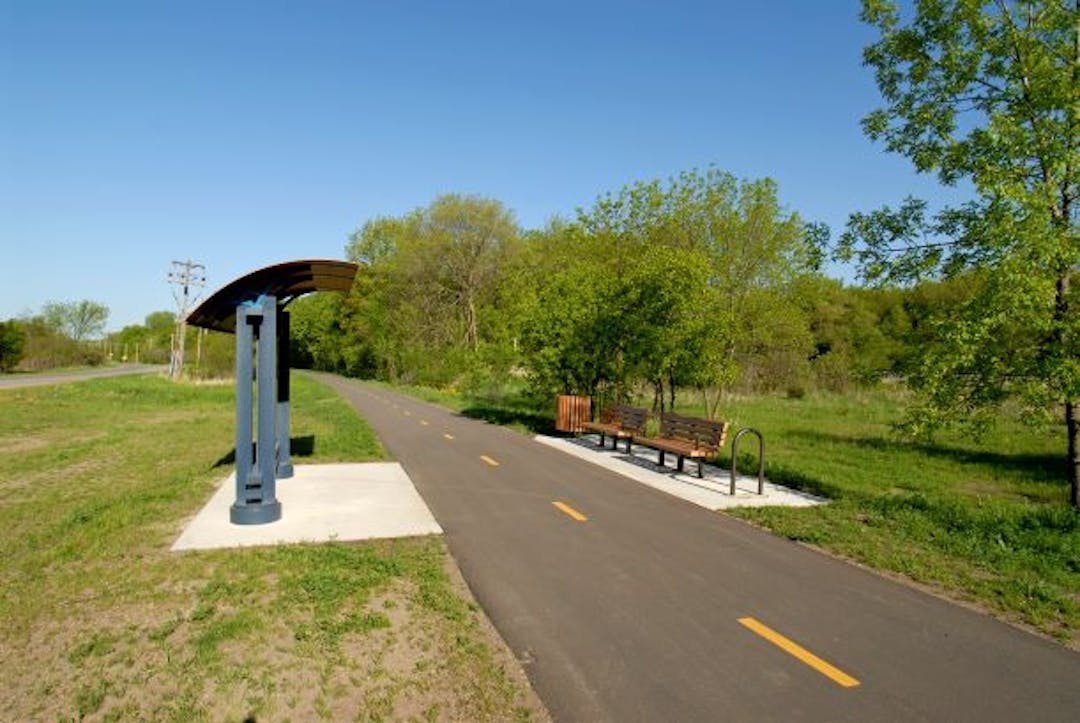
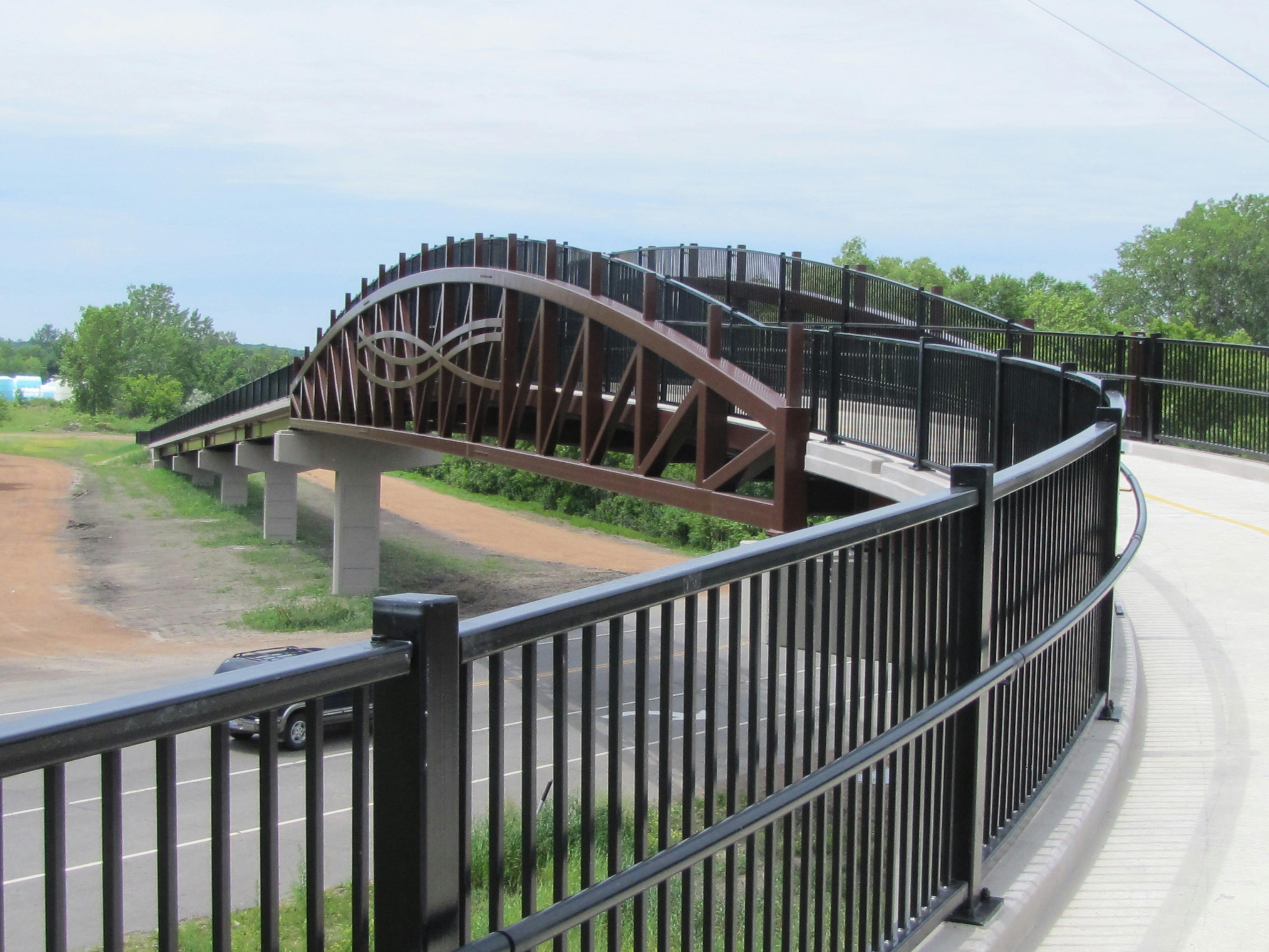
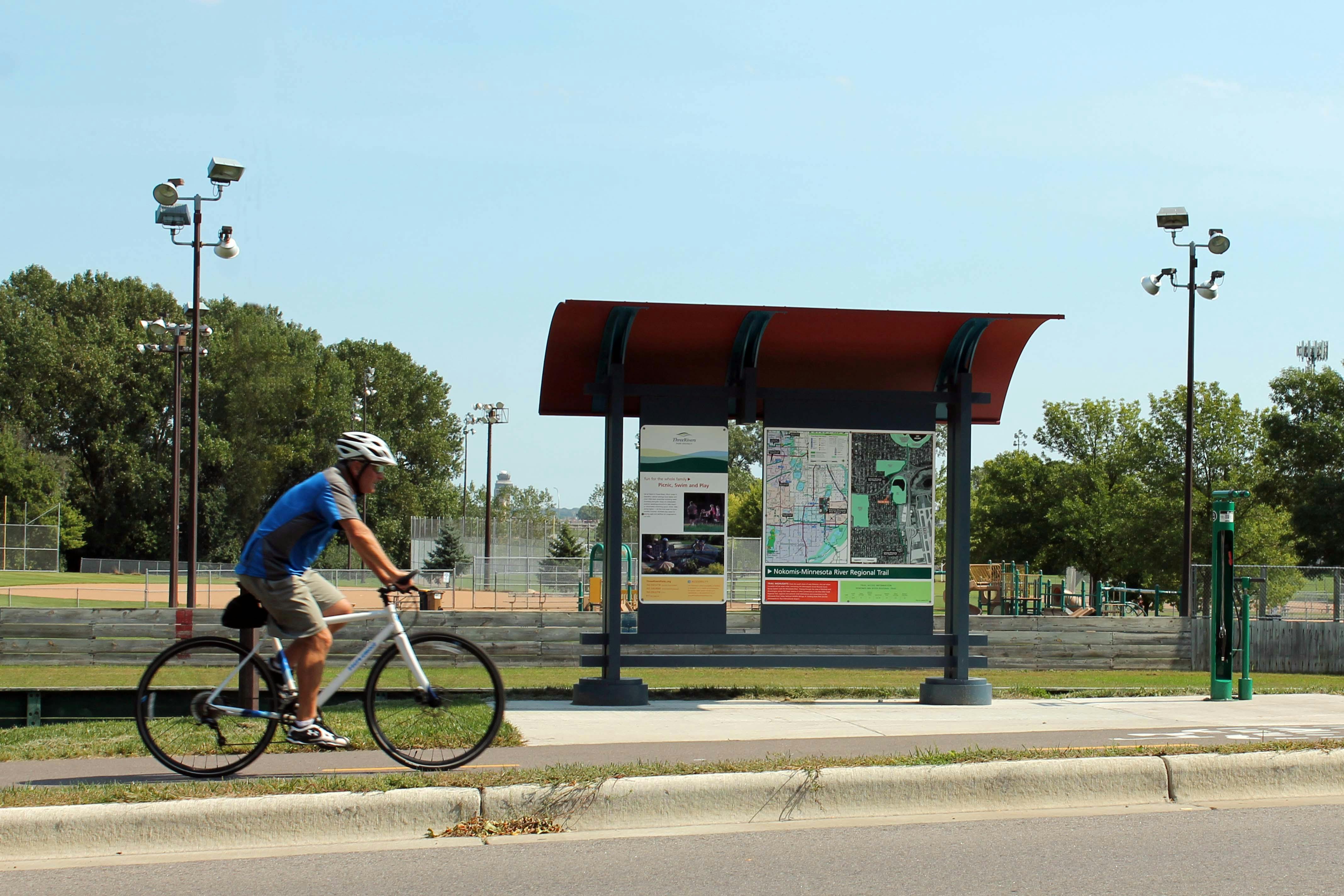
Three Rivers Park District is leading a master planning process for the Diamond Lake Regional Trail - a new north-south 10-foot-wide paved, multi-use regional trail through western Hennepin County which would allow biking, hiking, dog walking, running, and in-line skating.
In 2020, Three Rivers obtained extensive feedback from the community and coordinated with city partners along the proposed route to determine and approve the preferred route for the regional trail. The Diamond Lake Regional Trail is now envisioned to connect to the West Mississippi River Regional Trail in Dayton at its northern terminus and travel through Rogers and Corcoran to the Lake Independence Regional Trail and Baker Park Reserve in Medina at its southern terminus. After additional public engagement in 2021 and at the request of the cities of Medina and Long Lake, the preferred route for the regional trail will avoid southeast Medina and the City of Long Lake.
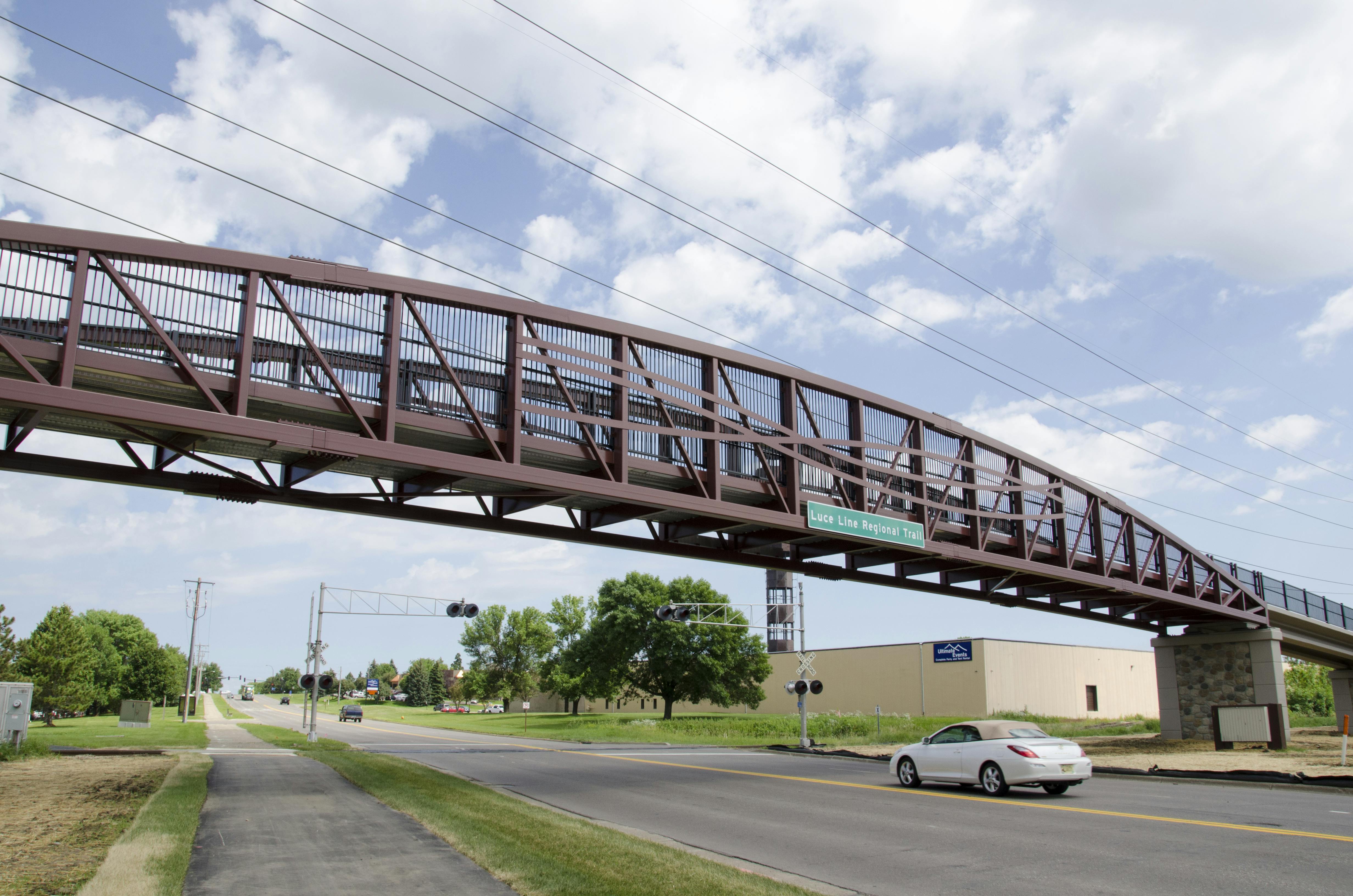
This planning effort also envisions a north-south trail connection in Wayzata and Orono linking the Dakota Rail Regional Trail and Luce Line State Trail. This trail connection will be called the Dakota Rail – Luce Line Connector Regional Trail. This trail connection, along with the existing trail connection of the Luce Line State Trail and the Lake Independence Regional Trail, will provide the contiguous trail route that was originally envisioned for the Diamond Lake Regional Trail corridor.
For quick reference, a PDF map of the preferred route for the Diamond Lake Regional Trail approved by each community is available here.
A detailed, interactive map for the preferred route is available here.
30-Day Public Comment Period
Three Rivers Park District has completed the draft master plan for the Diamond Lake Regional Trail and Dakota Rail – Luce Line Connector Regional Trails.The 30-day public comment period took place from May 4, 2022, through June 3, 2022. View the updated draft master plan.View the master plan appendices, including comments received during the public comment period.
Following Metropolitan Council approval and final adoption of the completed master plan by the Three Rivers Park District Board of Commissioners, Three Rivers will work to secure funding and work with willing sellers and partners to secure required property rights and commence trail construction. Trail construction will occur in multiple phases as funding and development opportunities allow and will likely take two to three decades to fully achieve.
Project Background and Status
Three Rivers Park District is leading a master planning process for the Diamond Lake Regional Trail - a new north-south 10-foot-wide paved, multi-use regional trail through western Hennepin County which would allow biking, hiking, dog walking, running, and in-line skating.
In 2020, Three Rivers obtained extensive feedback from the community and coordinated with city partners along the proposed route to determine and approve the preferred route for the regional trail. The Diamond Lake Regional Trail is now envisioned to connect to the West Mississippi River Regional Trail in Dayton at its northern terminus and travel through Rogers and Corcoran to the Lake Independence Regional Trail and Baker Park Reserve in Medina at its southern terminus. After additional public engagement in 2021 and at the request of the cities of Medina and Long Lake, the preferred route for the regional trail will avoid southeast Medina and the City of Long Lake.
This planning effort also envisions a north-south trail connection in Wayzata and Orono linking the Dakota Rail Regional Trail and Luce Line State Trail. This trail connection will be called the Dakota Rail – Luce Line Connector Regional Trail. This trail connection, along with the existing trail connection of the Luce Line State Trail and the Lake Independence Regional Trail, will provide the contiguous trail route that was originally envisioned for the Diamond Lake Regional Trail corridor.
For quick reference, a PDF map of the preferred route for the Diamond Lake Regional Trail approved by each community is available here.
A detailed, interactive map for the preferred route is available here.
30-Day Public Comment Period
Three Rivers Park District has completed the draft master plan for the Diamond Lake Regional Trail and Dakota Rail – Luce Line Connector Regional Trails.The 30-day public comment period took place from May 4, 2022, through June 3, 2022. View the updated draft master plan.View the master plan appendices, including comments received during the public comment period.
Following Metropolitan Council approval and final adoption of the completed master plan by the Three Rivers Park District Board of Commissioners, Three Rivers will work to secure funding and work with willing sellers and partners to secure required property rights and commence trail construction. Trail construction will occur in multiple phases as funding and development opportunities allow and will likely take two to three decades to fully achieve.
If you have general comments about the Diamond Lake Regional Trail planning process, please share them here.
You need to be signed in to comment in this Guest Book. Click here to Sign In or Register to get involved
This is a great idea to loop in the new residential growth occurring in Medina/West Plymouth to access trails without the need to drive to a trail head.
Max
Over 5 years ago
I love the idea of additional bike paths. It is amenities such as these that make Minnesota a great place to live. However, addition another trail head to Wayzata will exacerbate two issues: lack of adequate parking and crowded roads. There is not enough parking at Wayzata beach to a accommodate the current users of the bike paths, beach and marina. What is the plan to create more parking?
The roads are already too crowded with bikers, cars and pedestrians. Many of the more serious bikers ignore road signs, and bike in the roads even when a path is available along side the road creating serious safety issues.
I recommend creating a trailhead, with adequate parking somewhere north, around the area of County Road 6. Those of us wishing to bike north would not add to the congestion in Wayzata. And, those of us who want to access the Luce Line could bike south, splitting the traffic to Luce Line to come from both directions
Hennepin county resident
Over 5 years ago
This is a good idea. I hope snowmobiles and horses are considered for use on the trail(s) as well.
Stevejo
Over 5 years ago
In general, I am supportive of new trails that will support bicycle commuting from place to place (as opposed to driving a car) - especially if some of the trails might also be cleared for travel in the wintertime. It seems like that is the main goal of this project? For recreation activities, I'd rather see more unpaved rec trails & more protected park lands between communities... horse style trails that can be used for nordic skiing, running, walking/hiking, snowshoeing, etc. Those could then always be paved as needs shift in the future. We have quite a few paved trails already (I am a cyclist/runner/inline skater/skiier). I'd just like to suggest that we be mindful of the best thing for the health of the community and the ecosystem in which we live.
katiej1111
Over 5 years ago
Please remove Ferndale Rd (Wayzata Blvd to Lake St.) from your consideration set. The road already has an enormous amount of traffic as cars/trucks/construction vehicles use it as a preferred link between Wayzata Blvd & Shoreline Dr. In addition, as the city further develops condo's and other developments towards the west end of Lake St., one can only assume that traffic will continue to increase on this section of road. Alternatively, a link further West or East could be made on a much quieter street and would provide more safety to the pedestrians, bikers, etc. who would be using the trail.
traffic
Over 5 years ago
I am supportive of bike trails, but want to planners to understand characteristics of some of the proposed routes. (1) Several of the proposed routes go near to the Wolsfeld Woods, a scientific and natural preserve, and I am concerned about bikes trepassing in Wolsfeld. (2) The area particularly west of Tamarack and south of 55 has many horse properties and trail riding. Bikes can often spook from horses. (3) There are many wetlands in the Medina area that need to be protected. (4) Baker Park is just west of this area and has a long north/south bike trail along County Rd 19. Why not use that as a part of this plan? (5) When Medina paved some of its roads around 30 years ago, the roads were made extra-wide with a bike lane. Be sure to add this to your planning.
Mav
Over 5 years ago
Connecting Wayzata north is AMAZING. Thank you!
Barry is far too dangerous for this connection, given it's blind curves
Ferndale is the only option, and it's a NEEDED option. This is the path everyone uses and it's currently extremely dangerous, since there is no shoulder and cars are not generous. It's always matter of time before more kids biking on Ferndale get hit.
Don't let the 2 Ferndale neighbors who have created multiple accounts and have sent around a blanket text to use persuade you otherwise. This is people who don't want to have bike traffic "in their yard". Ferndale truly is your only option and it has two effects - making Ferndale traffic safer and avoiding a very dangerous Barry Ave. The fact that so many people already choose that option IN SPITE of its clear dangerous should be all the validation you need that this is the right choice!
THANK YOU for doing this!
Wayzata citizen
Over 5 years ago
I am a frequent user of many trails and while the idea of connecting them sounds great, safety must be the number one concern. Connecting to Wayzata sounds great - but it must be done safely - and there are really only 2 options. 1 - Connecting to the new trail head in Wayzata which is now at Broadway. Broadway north is a straight road and there is a light at the intersection of Wayzata Blvd. 2 - Connecting to the path via Ferndale which makes the most sense. It is the most direct route, is a straight road, could easily be expanded, there is already a four way stop at Wayzata Blvd and minimizes the amount of traffic on Wayzata Blvd. The current route during the detour this summer in Wayzata that takes people on Barry has shown this is not a viable option. It is the most dangerous road in the city. It is not a straight road (which you cannot fix) and the intersection with Wayzata Blvd is at a dangerous angle with numerous accidents this summer - both car accidents and bike accidents.
Trail User
Over 5 years ago
We do need this trail, and more like this. The nimbyism of some residents is typical, yet they can be a vocal and powerful minority. Please devote budgets for proper research to get a good sense of majority opinions.
Malenaink
Over 5 years ago
There are more motorized vehicles on the trails lately, usually going too fast, typically out of shape people on electric bicycles. Enforcement?
Malenaink
Over 5 years ago
Please do not bring the Diamond Lake Trail into Wayzata. I believe the trails should stay out in the nature and rural areas and not go through the residential areas. There has been a significant increase in traffic and population density on the west side of Wayzata. It would be a dangerous crossing over Wayzata Blvd and at the Ferndale/Lake Street or Barry/Lake intersections. Ferndale is already a very busy road and the traffic will only increase with the addition of more condominium buildings under development. The grade is significant and will result with bikers going into a high speed down the hill into a very busy intersection. There will be a significant impact to the residents along Ferndale to their landscapes and privacy, noise and pollution. In addition, the beauty of Ferndale will be ruined because you would have to cut down so many lovely trees along the road to accommodate the trail. This seems to be against the mission and values of Three Rivers Park.
WayzataResident
Over 5 years ago
I don't see the need for this trail. We already have a north/south trail coming out of Baker. Just link that up to the Dakota trail. You will save a ton of time and money. This area is more in need of east/west routes, as there is nothing north of Luce Line. If you do waste money on this, run it as far to the east as you can. There are more roads to follow which will be less of an impact for current residents. Plus more people live close by and will be able to use it. If you run the route to the west the trail will be inaccessible to most families and you will be destroying some beautiful wetlands and nature areas.
NatureLover
Over 5 years ago
Please do not put the bike path along Ferndale. Ferndale is already a way too busy street and often feels "like an accident waiting to happen" now.. It is difficult to imagine you would consider removing the beautiful trees which would not only be a detriment aesthetically but very damaging to the property values at the Meyers Place and Ferndale Ridge communities. Their properties are already too close to the road both from a privacy and safety position. Barry Avenue would be a better choice.
Jzitzloff
Over 5 years ago
As a resident who lives along Ferndale in the Ferndale Ridges and has a townhome that backs up to Ferndale a new trail along the East side of Ferndale would be very detrimental to property values as we would destroy our boulder retaining wall and cost the association a great deal of money to replace. There is just limited space along the East side of Ferndale for a trail. FYI Ferndale is a very busy road, and we don’t need any other traffic distractions. There must be a better alternative for a recreational trail as it will only serve a limited number of the community residents, so you shouldn’t ask the residents who live along Ferndale to accept this liability. Resident at 101 Edgewood Court, Wayzata.
ginnymarty
Over 5 years ago
Making the connecting route on Broadway makes the most sense by far. It will bring more business to downtown Wayzata and to the Pannaway Project and it is a straight connection to the Luce Line over the already existing I-394 bridge. Plus there will be a public bathroom for the bikers on the Pannaway project. This is long overdue to hook up The Dakota Trail and the Luce Line Trail. Both trails are great and this will make them even greater.
JS275
Over 5 years ago
Please take Ferndale Rd out of the possible routes. The canopy of tress that line the road are a beauty and very important part of Wayzata. This would be a big loss to all of us who drive this beautiful road daily. The trail being so close to the townhomes and offices on Ferndale would have a big impact on values and privacy of these properties. I question why a trail needs to go through Wayzata. The town has been torn up for three years, lets leave the town as is. I question if there is enough room on Barry Ave. Also, where is money coming from at this time of our economic crunch?
Wayzata resident
Over 5 years ago
Pease take Ferndale Rd off the possible plans.The canopy of trees lining Ferndale are a beauty to our town and a landmark.The loss of this would be a loss to all of us who drive this beautiful road daily.The close proximity to the townhome and offices would have a big impact on privacy and values of these properties. Barry Ave could be a better choice.However, I question going through Wayzata and tearing up the town more. Also, where is money coming for this project at this time of economic concerns?
Wayzata resident
Over 5 years ago
Love the concept to link up the various trails. Please consider some better access to snowmobile trails since new housing developments have removed many of the trails that used to be on private lands.
Wendy
Over 5 years ago
Please take Ferndale Road out of the possible routes. The canopy of trees lining the street is a treasure to our town. To lose this spectacular entrance to our town from the west would be such a sad loss for all of us who drive that road daily. Plus the close proximity to the current Ferndale Ridge townhomes would make the proposed trail a HUGE negative impact on the homeowners who reside there. It would necessitate a wall of some sort? Homeowners’ privacy and home values would be compromised. Barry Road would make a much better option. Thank you.
Wayzata homeowner
Over 5 years ago
Barry Avenue is the most logical option. Barry Ave. already has a wide street, sidewalk, and a bike right of way. A trail on either side side of Ferndale is dealing with a road with no decent right of way. For the homes on the east side of Ferndale, a trail extension option would remove privacy from those homes, and the townhomes fronting Ferndale. The HOA would bear significant expense to replace boulder walls, privacy walls and hedges/trees. Existing privacy would become a major casualty for all east side homes and townhomes.


This is a great idea to loop in the new residential growth occurring in Medina/West Plymouth to access trails without the need to drive to a trail head.
I love the idea of additional bike paths. It is amenities such as these that make Minnesota a great place to live. However, addition another trail head to Wayzata will exacerbate two issues: lack of adequate parking and crowded roads. There is not enough parking at Wayzata beach to a accommodate the current users of the bike paths, beach and marina. What is the plan to create more parking?
The roads are already too crowded with bikers, cars and pedestrians. Many of the more serious bikers ignore road signs, and bike in the roads even when a path is available along side the road creating serious safety issues.
I recommend creating a trailhead, with adequate parking somewhere north, around the area of County Road 6. Those of us wishing to bike north would not add to the congestion in Wayzata. And, those of us who want to access the Luce Line could bike south, splitting the traffic to Luce Line to come from both directions
This is a good idea. I hope snowmobiles and horses are considered for use on the trail(s) as well.
In general, I am supportive of new trails that will support bicycle commuting from place to place (as opposed to driving a car) - especially if some of the trails might also be cleared for travel in the wintertime. It seems like that is the main goal of this project?
For recreation activities, I'd rather see more unpaved rec trails & more protected park lands between communities... horse style trails that can be used for nordic skiing, running, walking/hiking, snowshoeing, etc. Those could then always be paved as needs shift in the future. We have quite a few paved trails already (I am a cyclist/runner/inline skater/skiier). I'd just like to suggest that we be mindful of the best thing for the health of the community and the ecosystem in which we live.
Please remove Ferndale Rd (Wayzata Blvd to Lake St.) from your consideration set. The road already has an enormous amount of traffic as cars/trucks/construction vehicles use it as a preferred link between Wayzata Blvd & Shoreline Dr. In addition, as the city further develops condo's and other developments towards the west end of Lake St., one can only assume that traffic will continue to increase on this section of road. Alternatively, a link further West or East could be made on a much quieter street and would provide more safety to the pedestrians, bikers, etc. who would be using the trail.
I am supportive of bike trails, but want to planners to understand characteristics of some of the proposed routes. (1) Several of the proposed routes go near to the Wolsfeld Woods, a scientific and natural preserve, and I am concerned about bikes trepassing in Wolsfeld. (2) The area particularly west of Tamarack and south of 55 has many horse properties and trail riding. Bikes can often spook from horses. (3) There are many wetlands in the Medina area that need to be protected. (4) Baker Park is just west of this area and has a long north/south bike trail along County Rd 19. Why not use that as a part of this plan? (5) When Medina paved some of its roads around 30 years ago, the roads were made extra-wide with a bike lane. Be sure to add this to your planning.
Connecting Wayzata north is AMAZING. Thank you!
Barry is far too dangerous for this connection, given it's blind curves
Ferndale is the only option, and it's a NEEDED option. This is the path everyone uses and it's currently extremely dangerous, since there is no shoulder and cars are not generous. It's always matter of time before more kids biking on Ferndale get hit.
Don't let the 2 Ferndale neighbors who have created multiple accounts and have sent around a blanket text to use persuade you otherwise. This is people who don't want to have bike traffic "in their yard". Ferndale truly is your only option and it has two effects - making Ferndale traffic safer and avoiding a very dangerous Barry Ave. The fact that so many people already choose that option IN SPITE of its clear dangerous should be all the validation you need that this is the right choice!
THANK YOU for doing this!
I am a frequent user of many trails and while the idea of connecting them sounds great, safety must be the number one concern. Connecting to Wayzata sounds great - but it must be done safely - and there are really only 2 options. 1 - Connecting to the new trail head in Wayzata which is now at Broadway. Broadway north is a straight road and there is a light at the intersection of Wayzata Blvd. 2 - Connecting to the path via Ferndale which makes the most sense. It is the most direct route, is a straight road, could easily be expanded, there is already a four way stop at Wayzata Blvd and minimizes the amount of traffic on Wayzata Blvd. The current route during the detour this summer in Wayzata that takes people on Barry has shown this is not a viable option. It is the most dangerous road in the city. It is not a straight road (which you cannot fix) and the intersection with Wayzata Blvd is at a dangerous angle with numerous accidents this summer - both car accidents and bike accidents.
We do need this trail, and more like this. The nimbyism of some residents is typical, yet they can be a vocal and powerful minority. Please devote budgets for proper research to get a good sense of majority opinions.
There are more motorized vehicles on the trails lately, usually going too fast, typically out of shape people on electric bicycles. Enforcement?
Please do not bring the Diamond Lake Trail into Wayzata. I believe the trails should stay out in the nature and rural areas and not go through the residential areas. There has been a significant increase in traffic and population density on the west side of Wayzata. It would be a dangerous crossing over Wayzata Blvd and at the Ferndale/Lake Street or Barry/Lake intersections. Ferndale is already a very busy road and the traffic will only increase with the addition of more condominium buildings under development. The grade is significant and will result with bikers going into a high speed down the hill into a very busy intersection. There will be a significant impact to the residents along Ferndale to their landscapes and privacy, noise and pollution. In addition, the beauty of Ferndale will be ruined because you would have to cut down so many lovely trees along the road to accommodate the trail. This seems to be against the mission and values of Three Rivers Park.
I don't see the need for this trail. We already have a north/south trail coming out of Baker. Just link that up to the Dakota trail. You will save a ton of time and money. This area is more in need of east/west routes, as there is nothing north of Luce Line. If you do waste money on this, run it as far to the east as you can. There are more roads to follow which will be less of an impact for current residents. Plus more people live close by and will be able to use it. If you run the route to the west the trail will be inaccessible to most families and you will be destroying some beautiful wetlands and nature areas.
Please do not put the bike path along Ferndale. Ferndale is already a way too busy street and often feels "like an accident waiting to happen" now.. It is difficult to imagine you would consider removing the beautiful trees which would not only be a detriment aesthetically but very damaging to the property values at the Meyers Place and Ferndale Ridge communities. Their properties are already too close to the road both from a privacy and safety position. Barry Avenue would be a better choice.
As a resident who lives along Ferndale in the Ferndale Ridges and has a townhome that backs up to Ferndale a new trail along the East side of Ferndale would be very detrimental to property values as we would destroy our boulder retaining wall and cost the association a great deal of money to replace. There is just limited space along the East side of Ferndale for a trail. FYI Ferndale is a very busy road, and we don’t need any other traffic distractions. There must be a better alternative for a recreational trail as it will only serve a limited number of the community residents, so you shouldn’t ask the residents who live along Ferndale to accept this liability.
Resident at 101 Edgewood Court, Wayzata.
Making the connecting route on Broadway makes the most sense by far. It will bring more business to downtown Wayzata and to the Pannaway Project and it is a straight connection to the Luce Line over the already existing I-394 bridge. Plus there will be a public bathroom for the bikers on the Pannaway project. This is long overdue to hook up The Dakota Trail and the Luce Line Trail. Both trails are great and this will make them even greater.
Please take Ferndale Rd out of the possible routes. The canopy of tress that line the road are a beauty and very important part of Wayzata. This would be a big loss to all of us who drive this beautiful road daily. The trail being so close to the townhomes and offices on Ferndale would have a big impact on values and privacy of these properties.
I question why a trail needs to go through Wayzata. The town has been torn up for three years, lets leave the town as is. I question if there is enough room on Barry Ave.
Also, where is money coming from at this time of our economic crunch?
Pease take Ferndale Rd off the possible plans.The canopy of trees lining Ferndale are a beauty to our town and a landmark.The loss of this would be a loss to all of us who drive this beautiful road daily.The close proximity to the townhome and offices would have a big impact on privacy and values of these properties. Barry Ave could be a better choice.However, I question going through Wayzata and tearing up the town more. Also, where is money coming for this project at this time of economic concerns?
Love the concept to link up the various trails. Please consider some better access to snowmobile trails since new housing developments have removed many of the trails that used to be on private lands.
Please take Ferndale Road out of the possible routes. The canopy of trees lining the street is a treasure to our town. To lose this spectacular entrance to our town from the west would be such a sad loss for all of us who drive that road daily. Plus the close proximity to the current Ferndale Ridge townhomes would make the proposed trail a HUGE negative impact on the homeowners who reside there. It would necessitate a wall of some sort? Homeowners’ privacy and home values would be compromised. Barry Road would make a much better option. Thank you.
Barry Avenue is the most logical option. Barry Ave. already has a wide street, sidewalk, and a bike right of way.
A trail on either side side of Ferndale is dealing with a road with no decent right of way. For the homes on the east side of Ferndale, a trail extension option would remove privacy from those homes, and the townhomes fronting Ferndale. The HOA would bear significant expense to replace boulder walls, privacy walls and hedges/trees. Existing privacy would become a major casualty for all east side homes and townhomes.