
CP Rail Regional Trail Master Plan: Crystal, New Hope and Golden Valley Segment
CP Rail Regional Trail: Golden Valley/New Hope/Crystal
Luce Line Regional Trail to Crystal Lake Regional Trail Segment
Public Feedback: Phase 1 is Complete 
Initial feedback opportunities to help determine the preferred route of the future CP Rail Regional Trail through Golden Valley, New Hope and Crystal and between the Luce Line and Crystal Lake Regional Trails are now complete.
Three routes, displayed on the adjacent map, were available for consideration. Community members were welcomed to shared their feedback and preferred route through a wide variety of ways including community events, virtual and in-person meetings, email, an interactive map and more.
Staff are now reviewing the public feedback and completing preliminary route feasibility assessment work.
A staff recommendation for review and consideration by the respective city commissions and councils is anticipated in October/November of 2022. An opportunity for additional public feedback on the recommended route, preliminary route assessment work and high-level concept renderings is anticipated in early 2022.
Project Background
The CP Rail Regional Trail is envisioned as a north-south off-road multi-use, non-motorized recreational corridor spanning from the Crystal Lake Regional Trail in Crystal at Becker Park to the Minnesota Valley State Trail in Bloomington. The regional trail is being planned in segments to allow for thoughtful community engagement and detailed route analysis.
This master planning work is critical, as the original vision for the regional trail was to utilize the CP Rail corridor; however, this is not currently feasible and alternative routes are needed in order to provide a safe, comfortable and continuous north-south regional trail for people walking and biking in the near future. The master plan efforts will identify and study alternative routes to determine which option(s) best balances feasibility, cost, private property impacts, and safety.
Master planning for Segment A between the Minnesota Valley State Trail in Bloomington and Nine Mile Creek Regional Trail in Edina was completed in 2019 and Three Rivers is actively seeking funding opportunities to complete the associated missing trail segments and improve wayfinding along Segment A.
Share your comments
As a New Hope resident who lives on 36th and Winnetka, I would love a bike trail that goes north/south on Winnetka. Right now, it is really not pleasant to bike down and I think putting a regional trail down it would greatly improve the experience. I also like the idea of connecting the Winnetka path to Douglas, which would provide a nice East/west connector.
Where sidewalks exist, please keep them. And if there is none along the path, consider adding them.
Otherwise you will have a dangerous mess https://twitter.com/DaveBikeSki/status/1671304394204217345
Quebec should be a truck route due to all the businesses / warehouses. I do not want to bike next to semi. If there is not a lot of truck on Quebec it is because they currently cut through the neighborhood streets (Fairview/49th) rather than using Quebec. So that put Fairview/49th out too.
It would make the most sense to do it on Douglas, where every store is mainly located already. Please leave winnetka alone and untouched, we already have high levels of traffic on winnetka due to construction projects. It would be nice for residents of new Hope, to enjoy a park without other congestion.
If the path goes on any street with a sidewalk, please keep the sidewalk and add the bike path next to it. Do not make it a multi-use path or you are going to degrade the experience for each mode. Example: https://twitter.com/AshleyASalvador/status/1493732802780491778/photo/1
Where there is nothing currently, you should also separate mode if possible, but a multi-use path would be acceptable.
I feel it’s important for bikers and the community to have safe paths and routes to use. I drive both Douglas and Winnetka frequently for my commute and feel that street traffic is better managed on Douglas and would seem to be the safer option. It also seems that the least amount of railroads would need to be altered to accommodate this route. Since there is currently a bike lane on Douglas, would there be less work to the existing roads to add in a trail? Is there any data available on how much potential bike traffic this trail in expecting to draw? I am also curious as to how many residential properties will be affected by each proposed route. As a Crystal resident I am a bit disappointed to only be hearing about this project in what appears to be the later stages. Were the residents notified earlier on and something was missed? Again, not opposed to the idea of a trail, just looking for more details from a residents perspective. Thank you.
Will the trail go on the East side of Winnetka? That would make the most sense.
I walk from Yunkers park (Winnetka Hills) to Bassett Creek everyday. I used to live on the trail. Now that I don't, it seems like east and west are not connected. You could look at 32nd ave between nevada and winnetka as a missed opportunity to serve a large community of apartment living. The road is incredibly wide and people walk there all the time only to encounter trucks/trailers parked and busy drivers. Not a pleasant way to get from new hope to crystal and/or to the bigger connections. Winnetka hills has a ton of walkers and no place to walk! Just west of us, we have trails in New hope which are not well maintained but are good for walking. With so much emphasis on the larger trails, please do not forget the arteries that can support this initiative. People want to walk, bike, excercise for a variety of reasons. If it's difficult for people in the neighborhood to access them, they won't enjoy the bigger benefits of what you are doing. I only walk through the industrial area because I know how great the Bassett creek trail is. This is a small request for a great way to connect the east and west sides of town. Getting from 100 to 169 should be easier for us. And, perhaps there is a better way to get to medicine lake (Bicycle / Walking Bridge about at 32nd) to get across. The only way now is an old unsafe sidewalk on medicine lake road(or 36th). Thanks for listening!
Our manufacturing business is located on Quebec Ave., will the proposed trail be on the road or would a new sidewalk/path be added on this stretch of the path? If a new path where exactly is the proposed location?
As a recreational rider who lives at the north end of New Hope, I would be very happy to have a north/south route connecting me to some major bike trails. Here are my comments about what things are important to me:
1. Pretty and quiet trail - I have recently discovered I could ride south on Quebec rather than riding on Winnetka. That was a major discovery. It's pretty and quiet. However, even though it is not too inefficient from my location, it would not be as efficient from Becker Park. It seems silly to go west and then back east again. But if the trail is nicer, it might be worth it.
2. Few intersections and as little traffic as possible - the route on Winnetka has a lot of intersections and traffic. It might be similar to the route going north on Bottineau Blvd from 63rd to Fleet Farm. That part of the trail is worthless. It's ugly. It cuts your bike riding time in half because of all the time you stand waiting at intersections. I would not be in favor of any route like that.
3. Off Road trail - Douglas Drive could work as long as the route is not on the road. I would not bother riding a trail that is a special section on the road. If I had to ride on that road anyway, it would be better than nothing, but I would not go out of my way to ride on that trail and for recreation purposes, I would choose a different one.
Thank you for giving us the opportunity to give feedback. I would be very happy to have a bike trail in this area. And if there is ever a way to connect the Crystal/Becker Park area to Eagle Lake in Maple Grove (or just to get across 169 more easily at the north end of New Hope), that would be much appreciated as well!
I would like to see the Basset Creek Regional Trail from east of Highway 100 highway completed to Theodore Wirth Parkway
Whether you opt for Douglas or Winnetka, please make the trail separate from the street (like it is on Boone or 36th). Biking on Winnetka and Douglas is entirely too busy, and if traffic is narrowed down to two lanes, drivers will get upset with bikers (or those waiting to turn left) and go in the bike lane.
Hi, I prefer the Douglas Drive optionz
Both planned routes have their benefits. A downside I see to Winnetka is the amount of traffic which bikers would encounter. Already
concerned with the lack of respect drivers through much of Winnetka neighborhoods I am concerned the addition of bikes and families would cause more safety concerns. Winnetka has become a main Avenue of traffic for emergency vehicles, traffic violator escapees, speed testing/racing drivers and no longer is the quiet road it once was. For this reason, the Winnetka/Douglas route, through community neighborhoods, would be a more enjoyable and safer ride.
Hello, my wife and I bike a lot and live just off Boone in New Hope. Placing the trail on Winnetka only OR Winnetka-Douglas would allow for more residents of New Hope to access the trails. Douglas-only trail cuts New Hope out of the equation and I doubt it would see much ridership from New Hope. Given New Hope destinations of HyVee, YMCA, Ice Arena and the new waterpark and green space near the New Hope City Hall, keeping the trail closer to New Hope is very beneficial. Also, the Winnetka options is in the middle between 169 and 100 that border the area.
For all these new trails, a few comments:
- When following a main road, it should be separated from the road, see to what has been done on N Plymouth Avenue in Minneapolis
- When following a main road, the trail should have the same priority on the side roads as the main road, see again what has been done on N Plymouth Avenue where all the side roads do not have priority on the bike trail
- Before putting on a stop on a trail, assess if a priority sign triangle would be more adequate especially when the trail has good visibility on the crossing road
- Never put a stop on a trail for drive ways such as what has been done in Orono on the Dakota trail where you have 13 stops for mostly home driveways on 2 miles!
- Overall, Minnesota needs to catch up on bike trails along main corridors (like along 55) or even in typical city streets where a bike trail should always be marked especially at lights; they need to be separated from walking path, minimize stops, be protected from cars. Some cities in the South like Tucson has a much wider network with bike trail or path along most main roads
I bike a lot along these trails, most of them are great (Elm Creek, Carver,…) but in between parks, they can be improved
The Winnetka option will be the greater improvement over current conditions. I bike on Douglas already; I will go out of my way to avoid riding on Winnetka. While I would love to see a Douglas trail I would rather have improvements on Winnetka. The Winnetka-Douglas option is not appealing.
Can we please get a couple of safe, off street north/south connections to the Cedar Lake trail? It's a shame that we can't ride from New Hope or Golden Valley straight down to Hopkins or St. Louis Park, especially where there are train tracks and highways that go north/south. Can we please think of actually getting somewhere on a bike/by walking instead of just recreation? If we could actually go shopping/go to work/go out to eat/go to the gym on our bikes/scooters, maybe more people would use the trails you build.
The Douglas route would establish important connections between areas that the City of Crystal seems to be investing in, Bassett Creek Park, City Hall, the Library, the Community Center and perhaps most importantly, in the context of the incoming Blue Line, the Becker Park area and "Town Center". This last item should be *directly* connected to the others and is why I think the Douglas route should be favored. This obviously has a Crystal bias and a personal perspective bias.
Re: City of Crystal investments. There are incentives for Storefront improvements along the Douglas route as well: https://www.crystalmn.gov/resident/community_development/storefront_improvement_program
This trail, no matter which route, should be off street family friendly walking/biking trails. Traffic on these streets is intimidating and dangerous even when we walk on the current sidewalks. We will look forward to walking/biking to businesses along the Winnetka corridor in the future and prefer the Winnetka trail! Thank you for this North/South route.
I feel this trail should follow the most direct route possible, along Douglas.
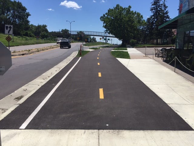
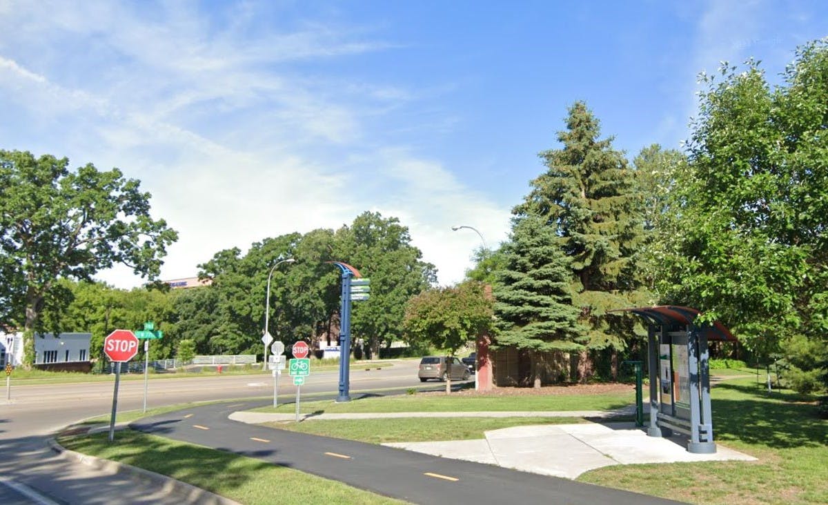
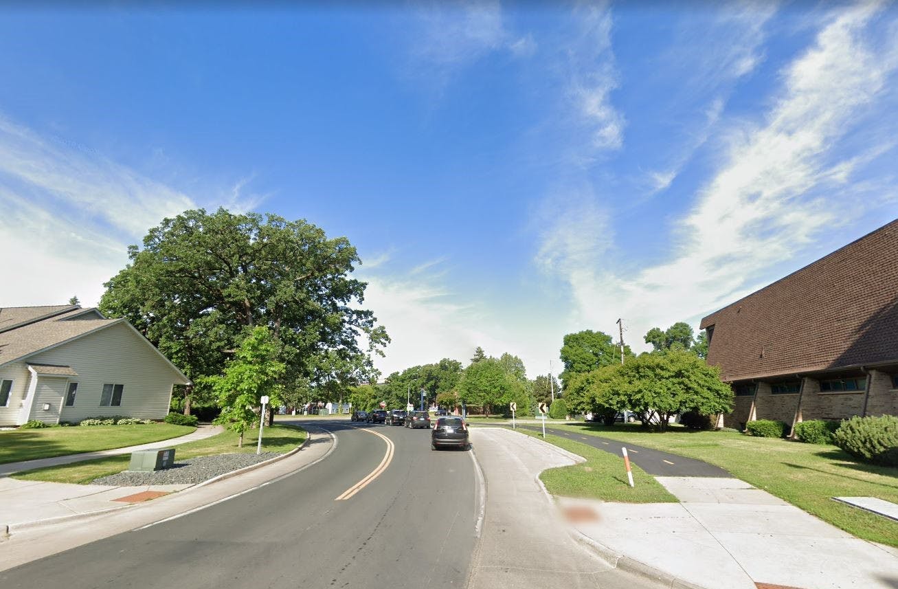
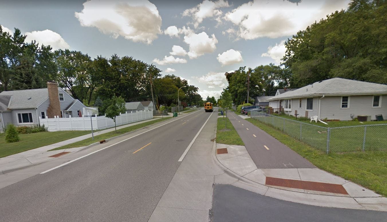
Photos
Background Materials
-
 CP Rail Regional Trail Master Plan_FAQ (309 KB) (pdf)
-
CP Rail Regional Trail Master Plan FINAL (23.4 MB) (pdf)
-
Paso A Paso Summary (331 KB) (pdf)
-
Bike Rodeo Summary (329 KB) (pdf)
-
Vehicle Fair Summary (315 KB) (pdf)
-
CP Rail Regional Trail Master Plan Trail Segments2_higher res.jpg (449 KB) (jpg)
-
CP Rail Regional Trail_July Engagement Summary (440 KB) (pdf)

Thank you for your contribution!
Help us reach out to more people in the community
Share this with family and friends